
Providence Canyon State Park Canyon Loop Trail - Lumpkin, Georgia
by Rebecca Hollman
updated Dec 15, 2019
Providence Canyon State Park - Lumpkin, Georgia
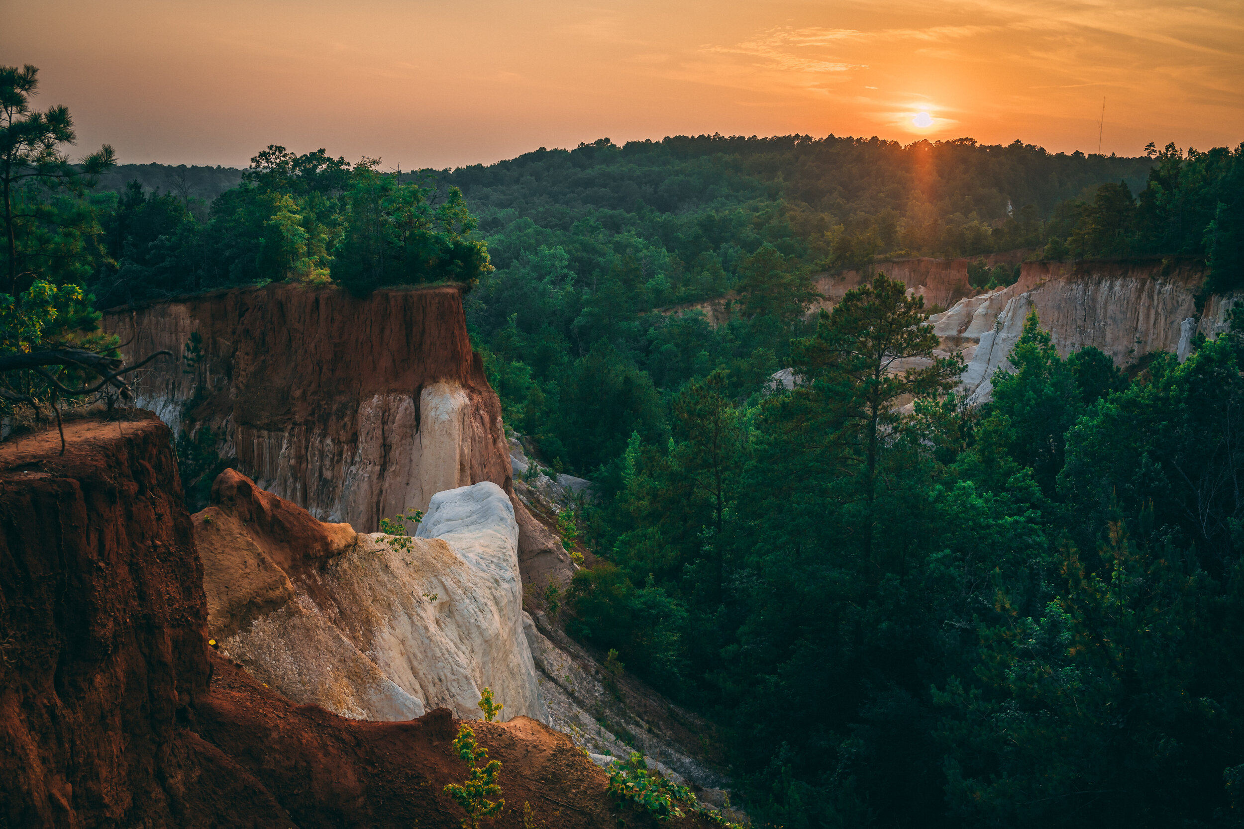
A true gem in south Georgia, Providence Canyon State Park looks like nothing else in the entire state. Although the reason the canyon exists is because of bad agricultural practices, the canyon can now be used as a learning lesson and a state park to enjoy from here on out. The vast canyon has crumbling red, orange and white sides and can be explored via the rim trail around the top or into and along the bottom of the canyon. Only a 2 hour drive from Atlanta and with camping options, this is a great weekend or one day getaway.
Table of Contents


About the Canyon:
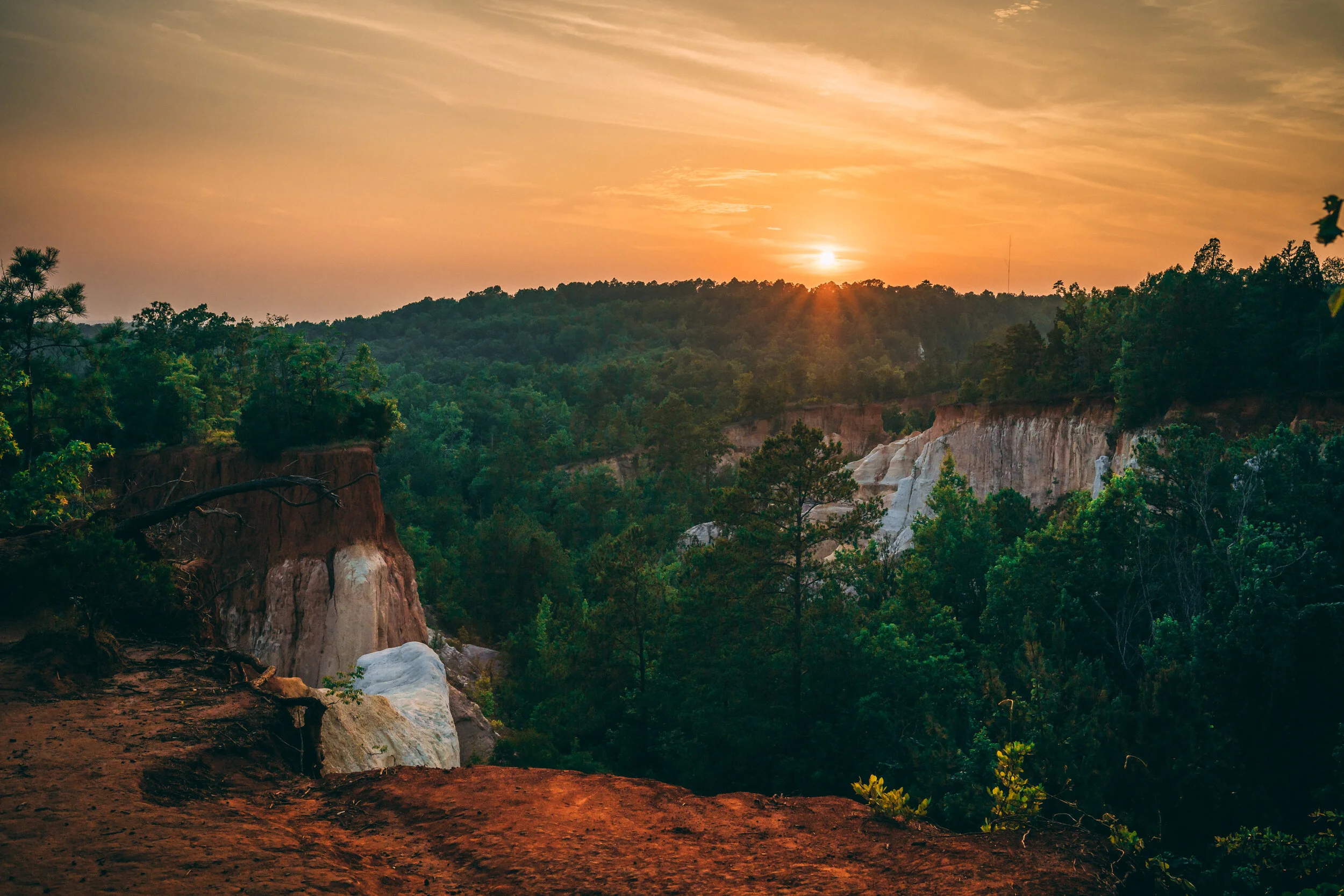
The canyon is a network of gorges created by the erosion of soft multi-colored soils. It is considered one of Georgia “7 Natural Wonders” and the state park has over 16 canyons, some as deep as 150 ft tall. A lot of people call the canyon “Georgia’s Grand Canyon” and although it looks similar, it comes from a very different start. The Grand Canyon and the many canyons of Southwest USA were formed by rivers and streams. Providence Canyon was formed by water runoff from surrounding farmlands, and technically isn’t a natural formation at all.

Geology:
The canyon can be separated into four major components: The Baker Formation, The Clayton Formation, The Providence Formation and the Ripley Formation according to Sigrid Sanders from the Georgia Encyclopedia.
“The Baker Hill formation is the youngest and forms the uppermost part of soils in Providence Canyon State Park. Deposited about 59 to 62 million years ago during the Paleogene period, this formation does not appear in the canyon walls, but the entrance road to the park and the Interpretive Center lie on top of it.
The Clayton formation, visible in the top part of the canyon walls, also was deposited during the Paleogene period, about 63 to 65 million years ago, just after the age of the dinosaurs. Its fairly coarse sand is a reddish color, caused by the presence of iron oxide. Near the base of this formation, iron oxides have precipitated into a thin, dark layer of iron ore, which has been mined in some areas outside the park.
The Providence formation, also known as the Providence Sand, makes up most of the canyon walls. One hundred and nineteen feet thick, it was deposited during the Cretaceous period, about 67 to 70 million years ago. The upper layer of this formation consists of very fine sand mixed with a white clay called kaolin. The middle layer is coarser-grained and more colorful, with crossbeds stained yellow by limonite and purple by manganese. The lowest and oldest layer is a black and yellow mica-rich clay. This part of the formation is known as the Perote member and is visible near the bottom of the canyon.
The Ripley formation forms the canyon floor. Deposited during the Cretaceous period, about 70 to 74 million years ago, it is orange in color, and its composition varies from clay to a massively bedded sand. This formation is the richest of the layers in fossils, but it is poorly exposed and, in the park, mostly overgrown.”


About the Trail:
Providence Canyon State Park has 10 miles of trails, 7 miles that are considered “back country.” The Canyon Loop Trail goes around the rim of the canyon and gives you viewpoints overlooking the canyon below and the hills of Georgia in the background. It also leads you past an old homestead with a plethora of rusted out 1950s cars, in an old car graveyard. The Canyon Loop Trail then goes into the canyon and allows you to walk along the canyon bed and right up to all the pinnacles and canyon walls. If you plan on going into the canyon, definitely bring waterproof shoes as the canyon floor is constantly wet - and water and red clay mixed together lead to a messy disaster. You can explore around canyons 1-9 on the loop trail. There is another 7 mile backcountry trail, aptly named the Back Country Trail, that leads into the forest and to a few small lakes. Be prepared for mosquitos here in the summer time.


Trail Info:
The Canyon Loop Trail is a 2.5 mile loop that goes into the canyon and also back up and around the rim. The state park says the trail takes 2 hours but with all the stopping to take photos and explore, it took us more like 4 hours. The trail is extremely easy with only a small uphill section from the base of the canyon to the rim. Otherwise, the trail is extremely flat. On the canyon floor the trail is likely to be wet so wear appropriate footwear.
Trail Map:


Camping:
You can camp overnight at Providence Canyon by making a reservation at one of three pioneer or six backcountry campsites. Pioneer camps are private camping areas suitable for groups, and they're equipped with pit toilets and usually have water spigots and amenities such as picnic shelters and grills. Backcountry sites are undeveloped, and you'll have to bring everything you need, including water.
The backcountry campsites will be hike-in spots. This means you will need to carry your gear in with you along a few miles of trail. The pioneer spots are drive-in and so you can camp right next to your car. I would advise against camping in either location in the peak of the summer, the Georgia heat and bugs will ruin the experience. However, a camping trip during the spring or fall would be a great weekend trip.


Getting There:
From Atlanta, head south on I-85 until you reach LaGrange. You will split off of 85 onto 185, heading south toward Columbus. After passing through Columbus, 185 turns into state route 280 W. In Cusseta, take the exit onto state route 27 S. Take this all the way to Lumpkin where you will turn onto state route 39-C W. This road will lead you to the parking for the state park, where you can either enter into the visitor center, start walking along the loop trail, or just drive to vista points along the road.
The address is 8930 Canyon Road, Lumpkin, GA 31815. GPS Coordinates for Providence Canyon are N 32.064445 | W -84.921913


Park Information:
ENTRANCE FEES: It costs $5 to park at Providence Canyon State Park, and annual passes are available for $50. If you're 62 or older, you can get the annual ParkPass at a 50 percent discount, and active military and veterans with a valid ID can get 25 percent off.
HOURS: The park is open from 7 a.m.-6 p.m. from Sept. 15-April 14 and from 7 a.m.-9 p.m. from April 15-Sept. 14. The visitor's center is generally open on Saturdays and Sundays from 8 a.m.-5 p.m.
CAMPING FEES: Picnic shelters cost $35 to rent, pioneer campsites are $40 to $80 and accommodate 50 people per site, and backcountry campsites can be reserved for $10 a person.


