The 12 Best Hikes in El Valle de Antón, Panama

by Rebecca Hollman
updated September 30, 2020
El Valle de Antón, Panama
El Valle de Anton is a small town located in a luscious green valley of an inactive volcano crater – it’s the largest inhabited crater in the world! When the volcano blew its top a casual 3 million years ago, the crater became a lush, green valley surrounded on all sides by the remaining volcanic ridges. The volcano has sat dormant for thousands of years and now is a favorite weekend getaway for Panamanians and visitors looking to escape the city. It’s unique cooler micro-climate, abundance of hiking trails, and many unique environmental and natural attractions make El Valle a popular weekend destination, especially for local Panamanians. It draws adventurous Panama City crowds who want to get out to the “mountains” in only 2 hours. There isn’t much nightlife or partying here and it’s a small outdoorsy town, so be prepared to have a relaxing and tranquil experience here.
Check out the 12 best hikes to do in El Valle, Panama below
Table of Contents

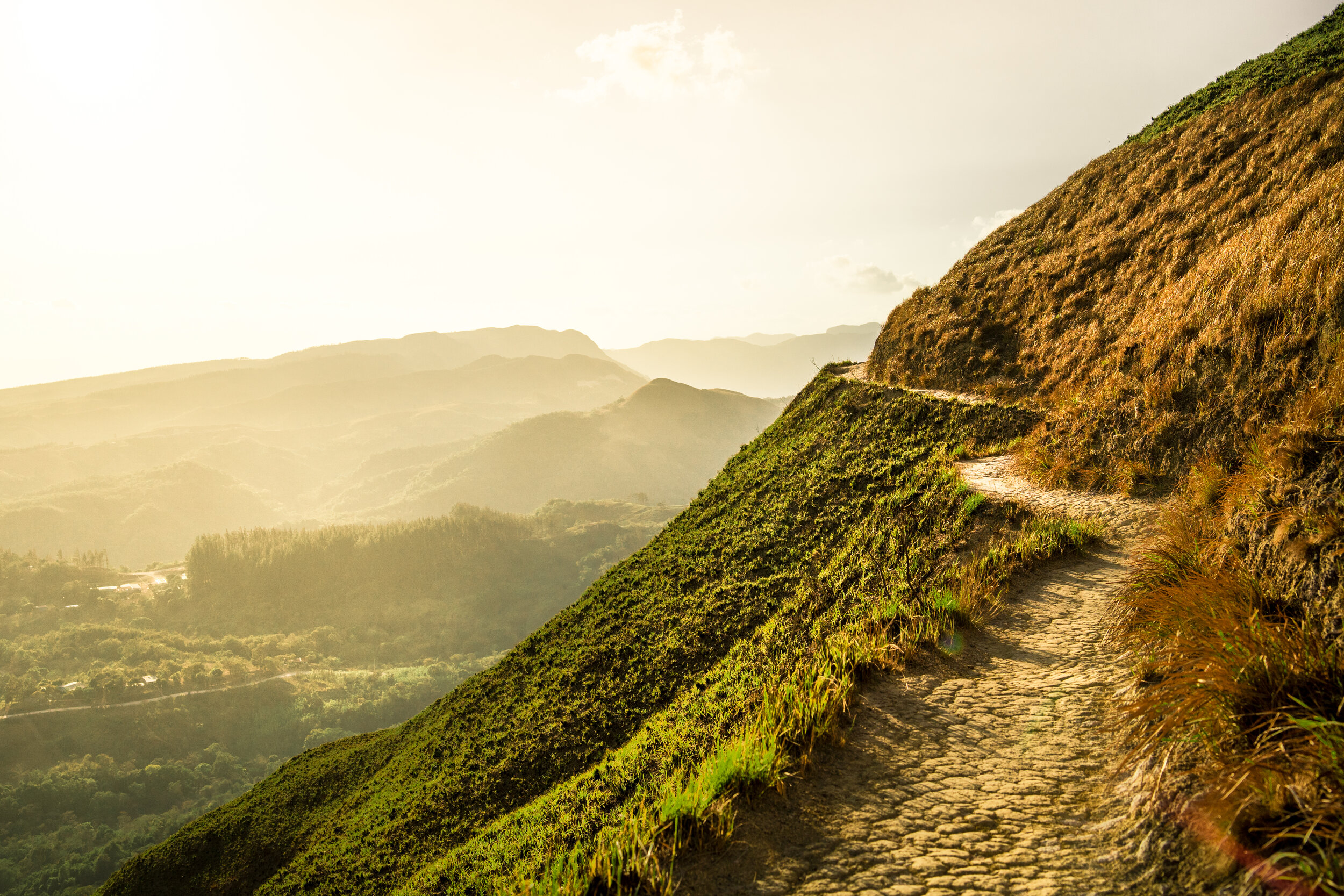
1. La India Dormida

ABOUT:
This hike leads up from El Valle town along the volcanic mountain ridges surrounding the town. If you start from the popular trailhead, you will pass a famous rock with pre-Colombian carvings and also a waterfall before reaching the crest of the ridge. You then follow the ridge line for awhile, seeing epic views in both directions. If you do the trail as a loop, you will descend the ridge line and come back to a main road, which you will follow back into town. Otherwise, you can turn around at any point and head back the way you came from. If you start at this trailhead, there is a $2 parking/entrance fee and someone regularly watching the entrance. This is also the popular way so there will usually be many cars along the roads and big crowds. You can also access the trail from where it intersects with the highway going out of town at Mirador Cerro La Cruz. Here you can park at the lookout point along the highway and head up the trail the opposite direction. You would follow the trail up the ridge line going north and back into town and then could either turn around at any point or continue on into town and back along the road to make a complete loop.
GETTING THERE:
This trail can be done in many different ways, giving different total lengths and distance. The most popular way is to start at the trailhead below, at the Piedra Pintada, and go up the mountain side. You could either continue this and reach the main road and walk back into town to make it a continuous loop (6.2 miles) or you could stop at the peak of the ridge and come back down the same way you went up. Total mileage for the whole loop is 6.2 miles and the up and back would be anywhere between 2-3 miles.
Learn more about La India Dormida here
TRAIL MAP:
2. Cerro Cara Iguana

ABOUT:
This moderate hike starts with a pretty brutal uphill trek along a dirt road that switchbacks for about a mile or two miles. You step off the dirt road where there is a small green ranger hut and into a forest. The trails goes through the forest up a little bit more until it opens up into an exposed ridge line. As the trail keeps winding up you finally crest over the edge and get your first views of the town. You have one final last stretch up to reach the summit of Cerro Cara Iguana, or “Iguana Face Mountain.” The trail goes back along the same way it came up. In total, the trail is roughly 4 miles depending on where you start. You can drive farther up part of the dirt road and park along the side of the road if you want to make the trail shorter or you can walk all the way from town. The road isn’t passable without 4WD at some point and there are many parking spots along the side of the road that are pretty obvious before the road gets too bad.
This 4 mile hike gains roughly 1200 ft over a few hours of hiking. It starts along a dirt road that switchbacks up a very steep section that comprises more than half of the trail. The rest of the trail goes across the open ridge line until you finally reach the final summit, which gives stunning views of the town.
GETTING THERE:
From the main road, you turn down Calle del Macho - towards the more residential area of the town. Once you reach the hot springs on the right, turn left on Avenida los Millionarios and then immediately right on the next road towards Petroglifo Cariguana (marked on the map below). Continue following this road until you reach the dirt road turn off on the right that is the start of the trail. Park anywhere along the road from the Petroglifo Cariguana to the dirt road turnoff. There are some pretty obvious pull off areas that give plenty of room to park. From there follow the dirt road up and continue along the trail.
Learn more about Cerro Cara Iguana here
TRAIL MAP:
3. Cerro Gaital

ABOUT:
This hike is the most intense in the area - requiring some technical skills and even some rope assistance in places. However, you can make the trail much easier by only going to the first lookout point. To reach the first lookout point, the trail meanders up through lush green forest for sometime until all of a sudden you pop out from under the trees onto a ridge line. This lookout area has a wooden platform and views of the surrounding farmlands. If you wish to continue further, the trail narrows and snakes past the platform. It immediately starts ascending straight up on a narrow ridge and up rocks. Most of the ascent (and descent) requires scrambling over rocks, using arms and handholds and some ropes. Do not attempt if the trail is wet or if there are strong winds (very common in this area during the dry season). This trail is super fun for adrenaline junkies but can be dangerous so please use caution. It is an out and back that covers only 1.3 miles in total but 1,355 feet in elevation gain.
GETTING THERE:
This 1.3 mile out and back gains 1355 ft of elevation. The second section of the trail is very strenuous and should only be attempted under good weather conditions. Wind or rain should stop you from attempting the climb. It requires some rock climbing and scrambling knowledge and some rope assistance may be required. The trailhead is marked by a yellow and green hut. Here you can pay your entrance fee to a ranger. You can park along the side of the road next to the hut. There is a gate blocking the trail so you can only enter if you pay.
Learn more about Cerro Gaital here
TRAIL MAP:
4. Cerro La Gaita
ABOUT: The trail begins as a steady incline. This beginning section is very slippery and covered in slick clay. Bring hiking shoes with a good grip if you have them. After 15 minutes of incline, the trail reaches a plateau. There is a barbed wire fence here but it is usually open. Once you reach this fence, you are about a quarter of the way up. There is about 15 minutes more until you reach the halfway point - the start of a staircase. You can technically drive up to the staircase but I wouldn’t suggest this - leave it to the tour guides with 4x4 trucks. The start of the stairs gives some relief from the slippery mud. The staircase winds up through the dense jungle and takes about 25 minutes going up. The stairway wraps around the side of the mountain with a steep final ascent to the summit. At the top, there is a platform that looks out over the region.
GETTING THERE:
To reach the trailhead you will cross over into the Panama Oeste province even though it is only a 20 minute drive from El Valle. The trail begins at the fork to Laguna de San Carlos. Here, you take the road to the left which heads up the hill.
TRAIL MAP:
5. Cerro Turega
ABOUT: Cerro Turega is the hike of “Three Peaks” in the town of Alto de la Estancia. You can drive to town or catch a bus from El Valle. Lots of locals are hanging around waiting to offer their guide services for the trail. You really want and need a guide for this trail. The hike is 6km but takes about 4 hours because of the steep and slippery terrain. After about 15 minutes into the trail, there is a river and small waterfall where you can swim and jump in. From the waterfall on, the trail is straight up the hill. The path ends quickly and a machete might be useful to get through the thick foliage. The ground is very slippery in the rainy season so most of your work will be pulling yourself up through the mud. There are three peaks at the summit but the trail only reaches the first.
GETTING THERE:
Cerro Turega is in Alto de la Estancia. If you take a bus from El Valle, it will drop you off right after the school where you will head down a road into the village on the right. You can either arrange for a guide in advance or test your luck and hope to run into a guide in the town.
TRAIL MAP:
6. Cerro La Silla

ABOUT:
This hike follows along the ridge of Cerro La Silla, on the outskirts of El Valle. The trail is relatively flat with little change in elevation - only around 300 feet. The trail can be narrow and steep in sections, but overall the trail is rated as easy. In total, the trail is 3 miles (or ~4 kilometers) in total and is an out and back. It is possible to hike to the trailhead from town, making the total trail length more like 7-8 kilometers. In total, the trail should take between 2-3 hours depending on how fast you walk. This trail gives amazing 360 views and is easily accessible and an easy hike, so great for families and children.
We started the hike around 4 pm and wanted to be out there for sunset. It took us about an hour and a half to reach the “last peak” although I’ve heard the trail does continue and makes a little loop that comes back around to the trailhead. It didn’t seem to us like the trail kept going so we turned around and went back the way we came. The walk out was awesome as the sun was starting to set and the temperature started to cool. The trail was very narrow and winded along some pretty steep ridges - the views all around were so dramatic! We reached the last peak as the sun set and sat down to take it in. It was so windy the whole time we thought we were going to lose our stuff if we set it down and we couldn’t get the drone out to fly it. Finally we headed back to the trailhead as it really started to get dark. By half way back we were in the pitch black using out phones as flashlights. Right before the last rays of sun were gone, there were some cool rainbow streak formations across the dark sky that I’d never seen before.
GETTING THERE:
From town, head east on 71 (Ruta las Uvas) which is the main road through town. About 10 minutes out of town, turn right on an unmarked dirt road (marked on the map below). Follow this dirt road as far as you can and park along the side of the road at any point. You will walk the rest of the way along the dirt road until you reach the very obvious trail. Follow the marked trail to the last peak of Cerro La Silla, and then follow the same trail back to your parked car.
Learn more about Cerro La Silla here
TRAIL MAP:
7. Golden Frog Hike
ABOUT: This short and flat hike starts on the property of the Golden Frog Inn. If you go to the hotel, ask the staff to show you the entry to the trail where you can search for the elusive bright yellow frog by yourself. Even if you don’t see a frog, you can still enjoy the flora and fauna along the way. This is a great hike for children and older adults who might struggle with the steep inclines of many of the other trails in the area.
GETTING THERE:
8. Cerro Chame

ABOUT:
This moderately strenuous hike starts out following a mellow dirt road (marked Quebrada Jose Arauz on the map below). Eventually the road starts to ascend and eventually the trail cuts sharp to the left leading the road - you might have to duck under some barbed wire here. We missed the trail turnoff originally, and then back tracked when we realized our mistake and saw it easily the second time. This part of the trail is under the cover of trees for a little bit before it opens up and you can see the mountain and the surrounding land in all it’s entirety. The trail continues to ascend until you reach the summit (the cross) at 500 meters above sea level. The mountain is actually more a cluster of peaks and you can follow the trail to the different summits, although doing so makes your total round trip roughly 13 kilometers in total. If you continue a little bit past the cross, you can see the ocean and also Malibu Beach below.
This trail has multiple end-point destinations so trail length can differ. The true summit is 3.4 kilometers from the dropped pin below. However, you can keep following the trail to multiple further peaks. If you take the trail to the last point and back, the whole hike could be 13 kilometers in total. The total elevation change to the true summit is 700 meters, more if you go to the final peak. It’s approximately 2 and a half hours from the dropped pin to the cross at the true summit.
GETTING THERE:
To get to the trailhead from the Pan-American highway from Coronado, turn right at the Delta gas station. At the end of the short road, turn left. Drive through the neighborhood until you leave the asphalt road and turn right onto the gravel road. You will see a sign that says Hogar Monte Carmelo. Next, turn right at the very large sign that says “Maduro Tropical Gardens”. There is another sign that says “Hacienda El Itsmeño” on a tree on the left side. When you see a long row of hedges ahead, turn left before the hedges. You will approach a sign that says Reforestation Chame. Park there along the road.
Learn more about Cerro Chame here
TRAIL MAP:
9. Tife Waterfall Trek
ABOUT: This 3 day, 2 night adventure over 30km leads to two epic waterfalls in the Omar Torrijos National Park. This is definitely an off-the-beaten-path adventure with very few tourists heading out here. There are several other hikes and viewpoints within Omar Torrijos National Park so it might be worth staying there for a few more days. There is a ranger station at the entrance to the park where you will need to sign in and tell the rangers where you are intending to go. The ranger station is 2 km up the road unless you have a legit 4x4 car or truck. From the ranger station, you continue following the road for 11 kilometers until you reach a house on the right side. Here you can find a local to be your guide. There are a few forks in the road - just stick to the bigger main trail. However, there is one point where you will veer to the left in the smaller road and the main road will dip down dramatically to the right. Once you reach the guide’s house, you can hire a guide (HIGHLY RECOMMENDED). From there, it is a 2 hour journey through the jungle. There is a chance to see some really cool wildlife like a tapir! After 16 km, you will finally reach one of the Tife waterfalls. From here, you can continue on to the second waterfall or head back the way you came to the guide’s house. After sleeping here another night, head out in the morning back down to the ranger’s station.
GETTING THERE:
Head to the entrance to Omar Torrijos National Park. There is a ranger station 2 kilometers from the entrance. This is the technical start of the Tife Waterfall trail. Most cars can’t reach the ranger station and so there’s an additional 2 kilometers that you need to hike from the entrance. Omar Torrijos National Park is about an hour from Panama City.
TRAIL MAP:
10. Cerro Picachos de Olá

ABOUT:
This short but steep hike leads to some of the most drastic scenery in all of Panama. The ridge line of Cerro Los Picachos rises up sharply out of completely flat valley and creates picturesque views in all directions. During sunrise and sunset, the colors around this ridge are incredible. In the dry season, the tall grass is strikingly yellow and orange and in the wet season it is neon green. Both situations create some amazing photos, especially for sunrise in the wet season and sunset in the dry season. There is very little information about this hike available on the internet and so I am not sure exactly how long the trail is in total. If I had to guess, it would be max 1 mile up and then 1 mile back down (more likely 0.5 miles up and then 0.5 miles back). The trail meanders through a farmer’s land until you reach the edge of the ridge line and then it goes straight up for a short time. Once you reach the first peak, the trail sort of peters off. Apparently you can keep following the trail to more peaks farther down the ridge line but the trail is very faint and hard to see.
The reason there is very little information about this trail is because the trail is on private land. So you should go out of your way to ask the farmer’s permission before entering his property. When we arrived, we hadn’t contacted anyone previously. However, when we pulled up and parked there was someone out in the fields and so we asked him if it was OK for us to go on the trail. I don’t know if he was actually the owner, but he didn’t seem like he minded at all that we were there. The trailhead starts by going through a gate onto private property and then another gate a few steps later. From there you walk through a pasture and around to the left to the base of the mountain. There the trail goes straight up the side of the ridge line and is very pronounced. If you can’t get in contact with anyone, I think it is still safe to access the trail (as they are used to hikers going on the trail) but please be courteous, quiet and don’t leave any trash behind.
GETTING THERE:
To get to the trailhead, head from El Valle to the small town of Ola - about an hour and a half drive. Once you reach the town of Ola, continue along the road you took in, following it as if you were heading to El Cristo de Ola, another small town. As you drive out of Ola, you will see the big mountain peaks along your left hand side and the road will start winding uphill. You will reach a house (marked on the photo below) and this is where the trailhead starts. Before the house on the left, there is a small space for parking. It can fit a maximum of 2 or 3 cars. Make sure your car is pulled all the way over, as the road is blind to this parking spot and so cars could swipe a parked car as they go past. From there, there is a small person gate that you can let yourself into. You will walk across this small cow pasture (with the house on the right) and then go through another person gate. Make sure you securely close the gates behind you as they have animals here. From there the trail goes to the left through an open, big pasture until you reach the edge of the mountain. From there, it rises up quickly to bring you to the summit of the first peak. If at all possible, you should try to get permission from the landowners before doing this trail.
There are no entrance fees or entrance hours as the trail is on private property.
Learn more about Cerro Picachos de Olá here
11. Cerro De La Cruz
ABOUT:
Cerro de la Cruz is a great sunrise or sunset hike in Altos de Campana National Park. If you want to hike it for sunrise, it will be an early 2:30 am wake up call. There is a small place to park next to a home where the trail marker is. The trail is muddy (in the rainy season) and uneven and the roots and constant steps make the hike strenuous, even though it’s less than 2 miles. It takes about exactly an hour to reach the top. From the viewpoint at the top, you can see the mangroves of Chame Bay as well as other mountains throughout the area. The viewpoint is at 905 meters above sea level. The round trip distance is 2.6 km and in total takes 2-3 hours.
GETTING THERE:
The trail head is just beyond the entrance to Altos de Campana National Park. There is a parking lot right after the entrance and the trail goes from the left hand side of the road.
TRAIL MAP:
12. Cerro Picacho de San Carlos
ABOUT: This trail leads to a peak in the town of San Carlos, known for its lake Laguna San Carlos. The trail is a steady incline through dense forests going over many roots and vines and underneath a canopy. There are two viewpoints along the trail. The first is a boulder that sticks out of the trail and gives a vantage point of the lake and the other peak. The other peak is incredibly steep and probably can only be accessed with climbing gear so don’t attempt unless going with someone who has done it before. From here, you can trek to the other lookout which is one the other side of the mountain. From this lookout you can see the ocean. Since you paid $1 to enter, why not hang out at the lake after your hike?
GETTING THERE: The drive from El Valle takes about 30 minutes up some seriously steep hills. Once you get there, you need to pay $1 to enter the complex. You will also be asked to pay $3 USD to park the car, although you can drive back 50 meters and park outside the complex for free. The trail is signposted with Sendero Cerro Picacho. The sign is about 100 meters back from the lake and you should see it on your right side as you drive in.
TRAIL MAP:
Find a Place to Stay in El Valle

Find Things to Do Nearby